Category Archives: Navigation
ParkMe Parking
 Park your car smarter and faster with ParkMe, the world’s largest and most accurate database of parking info.
Seapilot

Seapilot lets you navigate like a pro with vectorized S-57 chart data from National Maritime Administrations. Seapilot uses the Windows Phone built in GPS, so it works even when there is no mobile network coverage. This is the first navigation app to feature Automatic Identification System (AIS) and AIS weather in real time
GPS Voice Navigation
 * Handy dashboard with estimated time of arrival, time and distance traveled and more
* Voice Instructions
* Favorites
* Works with metric (km) and imperial (miles) units
Garmin HUD
 The Garmin HUD app provides detailed navigation information to your Garmin HUD+ device so it can beam turn-by-turn directions and more right onto your windshield for easy viewing while driving. To use the app, you must pair your phone with a Garmin HUD+ device via Bluetooth®.
Waze
 Waze is a fun, community based mapping, traffic & navigation app, 60 million strong. Join forces with other drivers nearby to outsmart traffic, save time & gas money, and improve everyone’s daily commute.
MapQuest
 Getting there has never been so easy! With the free MapQuest app for Windows Phone 8, you’ll get voice-guided navigation, traffic-aware re-routing, the ability to search for restaurants and other popular places, and so much more!
CoPilot GPS
 Find the best way to all the places you need to go with CoPilot. Detailed street maps of an entire country or region are stored on your phone, so you can plan routes and get driving or walking directions without a mobile internet connection.
Compass Deluxe
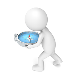 Look up a place and find it with 3D map navigation.
– create accounts
– create friend list
– friend tracking freature
– show speed, distance and altitude from friends
gMaps
+ Find your location on the map and track current speed
+ Layers support (street, satellite, traffic, bike, weather, etc)
+ Search for venues using powerful local search
+ Discover (advanced categorized customizable local search)
+ Directions (car, bicycle, public transit or walk)
+ Routes, alternative routes and restrictions
+ Ultimate Street View (360-degree, panoramic, ability to move)
Navitel

Navigation maps of Albania, Argentina, Belarus, Belize, Bosnia and Herzegovina, Bulgaria, Danmark, Costa Rica, Croatia, Czech Republic, Estonia, Finland, Greece, Guatemala, Hungary, Honduras, Kazakhstan, Kyrgyz Republic, Lithuania, Latvia, Macedonia, Mexico, Montenegro, Moldova, New Caledonia, Nicaragua, Norway, Panama, Poland and more.