OsmAnd Maps & Navigation
Description
 OsmAnd (OSM Automated Navigation Directions) is a map and navigation application with access to the free, worldwide, and high-quality OpenStreetMap (OSM) data.
Navigation
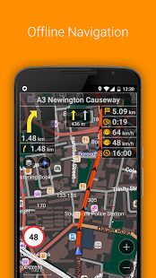
• Works online (fast) or offline (no roaming charges when you are abroad)
• Turn-by-turn voice guidance (recorded and synthesized voices)
• Optional lane guidance, street name display, and estimated time of arrival
• Supports intermediate points on your itinerary
• Automatic re-routing whenever you deviate from the route
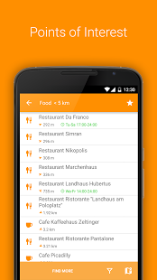
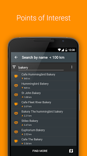
• Search for places by address, by type (e.g.: restaurant, hotel, gas station, museum), or by geographical coordinates
Map Viewing
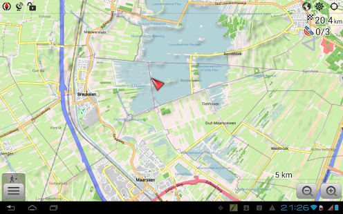
• Display your position and orientation
• Optionally align the picture according to compass or your direction of motion
• Save your most important places as Favorites
• Display POIs (point of interests) around you
• Display specialized online tiles, satellite view (from Bing), different overlays like touring/navigation GPX tracks and additional layers with customizable transparency
• Optionally display place names in English, local, or phonetic spelling
OSM Data
• High-quality information from the best collaborative projects of the world
• OSM data available per country or region
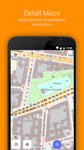
• Compact offline vector maps updated at least once a month
• Selection between complete region data and just road network (Example: All of Japan is 700 MB or 200 MB for the road network only)
Safety Features
• Optional automated day/night view switching
• Optional speed limit display, with reminder if you exceed it
• Optional speed-dependent zooming
• Share your location so that your friends can find you
Bicycle and Pedestrian Features
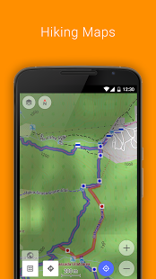
• Viewing foot, hiking, and bike paths, great for outdoor activities
• Special routing and display modes for bike and pedestrian
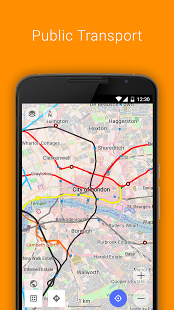
• Optional public transport stops (bus, tram, train) including line names
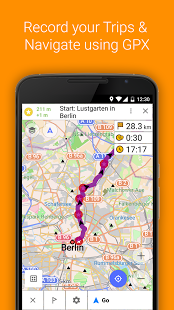
• Optional trip recording to local GPX file or online service
• Optional speed and altitude display
• Display of contour lines and hill-shading (via additional plugin)
Directly Contribute to OSM
• Report data bugs
• Upload GPX tracks to OSM directly from the app
• Add POIs and directly upload them to OSM (or later if offline)
• Optional trip recording also in background mode (while device is in sleep mode)
OsmAnd is open-source and actively being developed. Everyone can contribute to the application by reporting bugs, improving translations or coding new features. The project is in a lively state of continuous improvement by all these forms of developer and user interaction. The project progress also relies on financial contributions to fund coding and testing of new functionalities.
Approximate map coverage and quality:
• Western Europe: ****
• Eastern Europe: ***
• Russia: ***
• North America: ***
• South America: **
• Asia: **
• Japan & Korea: ***
• Middle East: **
• Africa: **
• Antarctica: *
Most countries around the globe available as downloads!
From Afghanistan to Zimbabwe, from Australia to the USA. Argentina, Brazil, Canada, France, Germany, Mexico, UK, Spain, …
Screenshots
What’s New
– New context-sensitive UI for tapping locations on the map and on other screens
Permission
Size: 45MB
Version: 2.2.3
Download
More Free Games & Apps Downloads:
 Matewire- Your Local & Outdoor
 GrubHub Food Delivery/Takeout
 Dwellable Vacation Rentals
 Scout GPS Navigation & Traffic
 MapQuest: Maps, GPS & Traffic
 Drink Advisor
 Meet Me Halfway
 SeatGuru
 Sygic Truck Navigation
 Foursquare
 Findery
 Hopper – Airfare Predictions
 WhaToDo – Tours & Activities
 Indian Railway Train Status